Amazon Neighborhood Association24th to 30th Avenues |
|
TABLE OF CONTENTS Meetings, current Masonic Cemetery Charter/Bylaws Website always in progress |
Eugene is located at 44°3'28" North, 123°6'37" West (44.057663, -123.110345) at an elevation of 426 feet.
According to the United States Census Bureau, the city has a total area of 105.0 km (40.6 mi), 104.9 km (40.5 mi) of it is land, and 0.1 km (0.04 mi or 0.10%) of it is water.
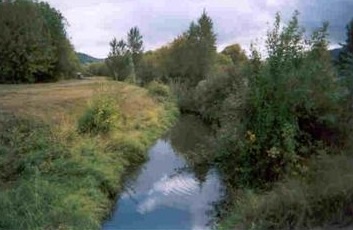
The Willamette and McKenzie rivers flow near Eugene and its sister city, Springfield.
Topographical map
Earthquake risk maps
Cemetery
Voter Precincts
Voter Districts
Map of Eugene/Springfield showing main streets
Neighborhood Mapquest Map
Covered Bridges in Lane County map
Aerial view of Downtown Eugene
Zoning maps
Traffic Patterns
Precipitation Map
Maps to purchase
Lane County Atlas (maps)
City Neighborhoods map
More geographic information available here
