Amazon Neighborhood Association24th to 30th Avenues |
|
TABLE OF CONTENTS Meetings, current Masonic Cemetery Charter/Bylaws Website always in progress |
HISTORY, More Distant
To participate and plan this page, contact the webmaster at maroz@comcast.net
| Distant Past - you are here |
Amazon Neighborhood's Donation Land Claim Homesteaders:
Sarah & Josiah Lakin
by Paul Cauthorn
Last winter I was wondering who obtained the donation land claim on what we know as the Amazon Neighborhood. So
I consulted the online BLM Survey records and discovered that “our” homesteaders were Josiah and Sarah Lakin. A little
searching on the Internet put me in touch with Virgene Travis a ggg-granddaughter of Josiah and Sarah Lakin. She was kind
enough to share her genealogy records for this article.
As her records show, the family came to Oregon in 1852 from western Illinois. This was the same year Eugene City was
platted and recorded. Their outfit consisted of five yokes of cattle, two cows, and two heavy wagons, with such provisions as
they thought were needed for the journey. Their party included Josiah and Sarah, their 5 children (David Redman, George
M., Lucy Jane, Zelda, and Martha), Sarah’s parents (Samuel A. Sweet and Polly Sweet), and a young man who lived with
Sarah’s parents. As was common in seven-month cross country journeys, Samuel Sweet at 79 years old died along the way.
A journey that began in April, 1852, was finally seeing the signs of completion on November 9, 1852, when the family spent
the night at the home of Jacob Spores at Coburg. This was the first night since their trip began that they slept indoors.
Under the Donation Land Claim Act of 1850, the couple was eligible for up to 320 acres. The Lakins
staked a pan-shaped 317+ acre claim just to the South of Fielding McMurray’s Claim. The NW corner
was 25th & Hilyard, the NE Corner was 25th & Agate, the west most SW Corner was 30th & Hilyard,
with a finger going all the way up between Agate and Onyx to 39th.
Sarah’s two brothers (Zara & Charles Sweet) had earlier filed and obtained claims to properties just east of our neighborhood –
between here and I-5. Sarah’s brother Zara Sweet later moved to the area that is now known by day
hikers as Sweet Creek in the coast range.
Many have believed that the Amazon Neighborhood was McMurray’s claim and in fact McMurray’s
did end up purchasing it in 1858, but McMurray’s official donation land claim ended at 25th Avenue.
The Lane County deed records show the ownership for the area of our neighborhood from 25th Avenue
to 30th Avenue transferred from Lakin to Gilham to Sweeney to McMurray. Interestingly, in plat
maps recorded in 1909 and 1910, 30th Avenue was shown as Lakin Street.
Along with farming, Josiah and his son David engaged in the work of hewing and hauling the timbers used in building
construction. They furnished some of the timbers used in the construction of the first Lane County court house; the Lakin
family also helped with the carpentry work on that structure. David set up a business building saddle trees for saddle makers,
and in 1872 he purchased the livery stable from S.M. Titus which was at 9th & Willamette.
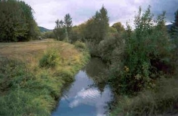
Sarah & Josiah's cabin was located in what is now the Laurelwood Golf Course on the west side of the course near Emerald
Street. If you were able to continue up 28th past Emerald Street into the golf course about 350 feet, you’d be approximately
where the first home in our neighborhood stood at the time of the land survey done by Andrew Patterson in 1854. (44.0271
N, -123.0701 W) This is near the third hole’s first tee box.
Josiah died in 1860 leaving $10 to each of his daughters, a life estate to Sarah his wife, and divided all other personal property
equally among Sarah and his two sons. In February of 1863, Sarah sold a portion of her life estate interest to her son David
for a two-horse wagon, two horses, and an annuity of $30/year. In 1865, Sarah married James W.
Peek, who died shortly thereafter, and was again married in 1868 to Zachariah Pollard.
Sarah, Josiah, and their children are buried at the Masonic cemetery in a lot north of the gravel road
leading up the hill to the public square.
Those interested in tracking down old Donation Land Claims can begin their search at: http://www.
lm.gov/or/landrecords/survey/ The Amazon Neighborhood is within township 18S, range 3W, section
5 & 8.